Book your Antelope Canyon tour before you book anything else, then build the rest of a Page trip around it. The best things to do in Page, Arizona are a Navajo-guided walk through Upper or Lower Antelope Canyon, Horseshoe Bend at sunrise, the overlooks above Glen Canyon Dam and a day on or beside Lake Powell. Two full days covers all of it at a sensible pace, and a third buys you the Toadstool Hoodoos, Lees Ferry or a sunset at Alstrom Point.
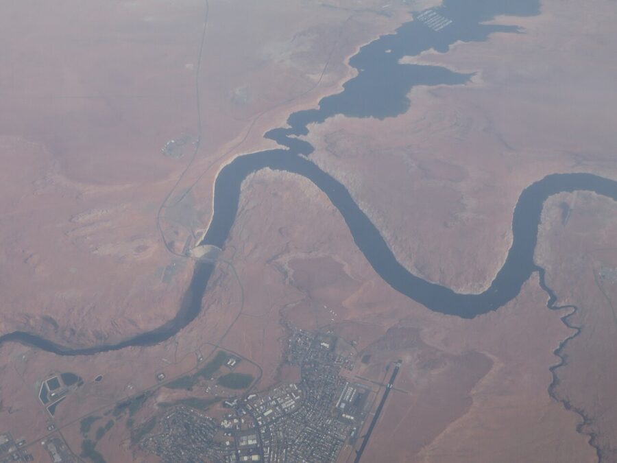
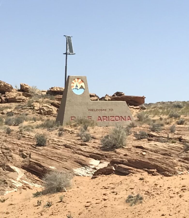
Page itself is a small, practical town on a mesa above the Colorado River. It began in 1957 as the camp for the workers building Glen Canyon Dam, and it still looks like it was laid out by engineers: a loop of streets, a row of churches, motels and diners along Lake Powell Boulevard, and big views at the end of almost every road. You come because almost everything worth seeing is within 20 minutes of a hotel bed.

Two things catch first-timers out. Antelope Canyon can only be entered with a Navajo guide, and the popular departure times sell out well ahead in spring and summer. And Lake Powell is low: on November 19, 2026, the Bureau of Reclamation recorded the surface at 3,540.62 feet, roughly 160 feet below full, which has closed several boat ramps and some of the classic boat tours.


On this page
- Page in brief: where it is and how to get there
- Antelope Canyon: guided tours only
- Horseshoe Bend
- Lake Powell
- Glen Canyon Dam and the overlooks
- Smaller things in and around town
- Day trips from Page
- Where to eat and drink
- When to go, and how long to stay
- A simple one- or two-day plan
- Getting around and practical notes
Page in brief: where it is and how to get there
Page is in far northern Arizona, on the edge of the Navajo Nation just below the Utah border. US 89 runs through it between Flagstaff and Kanab, which is why so many Grand Canyon and Utah road trips stop here.
Most people drive. Driving distances from the center of Page, by the most direct roads:
| From | Distance | Typical drive |
|---|---|---|
| Flagstaff | 134 miles | About 2.5 hours on US 89 |
| Grand Canyon South Rim (Grand Canyon Village) | 139 miles | About 3 hours via Cameron and AZ 64 |
| Phoenix Sky Harbor Airport | 282 miles | About 4.5 to 5.5 hours |
| Las Vegas Harry Reid Airport | 286 miles | About 5 to 6 hours via St. George and Kanab |
| Kanab, Utah | 74 miles | About 1.5 hours |
| Zion (Springdale, Utah) | 117 miles | About 2.5 hours |
| Salt Lake City | 386 miles | About 6.5 to 7 hours |
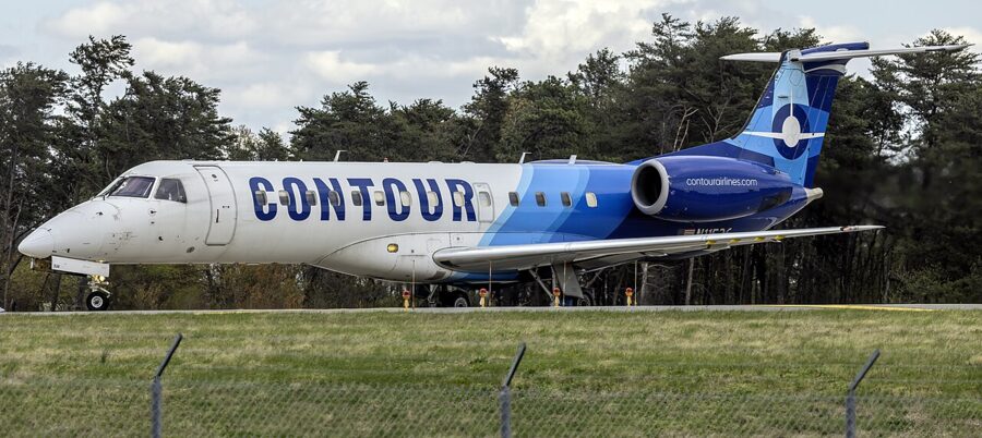
If you’d rather fly the last leg, Page Municipal Airport (PGA) has scheduled flights on Contour Airlines. Contour flies to Phoenix Sky Harbor, where it uses Terminal 4, on Embraer ERJ-135 regional jets, and the City of Page recommended it in April 2026 for another four-year Essential Air Service contract with Phoenix as the hub and Las Vegas as an added route. Contour added Las Vegas flights on July 2, 2026, four days a week; check the current schedule. You’ll still want a rental car, and the choice at a small airport is limited.

One quirk matters more than any other here: time zones. Arizona stays on Mountain Standard Time all year, but the Navajo Nation, which surrounds Antelope Canyon, observes daylight saving time from March to early November. The Antelope Canyon operators and the Park Service all state their times in Arizona time (MST), so ignore your phone if it jumps an hour on Navajo land.

Antelope Canyon: guided tours only
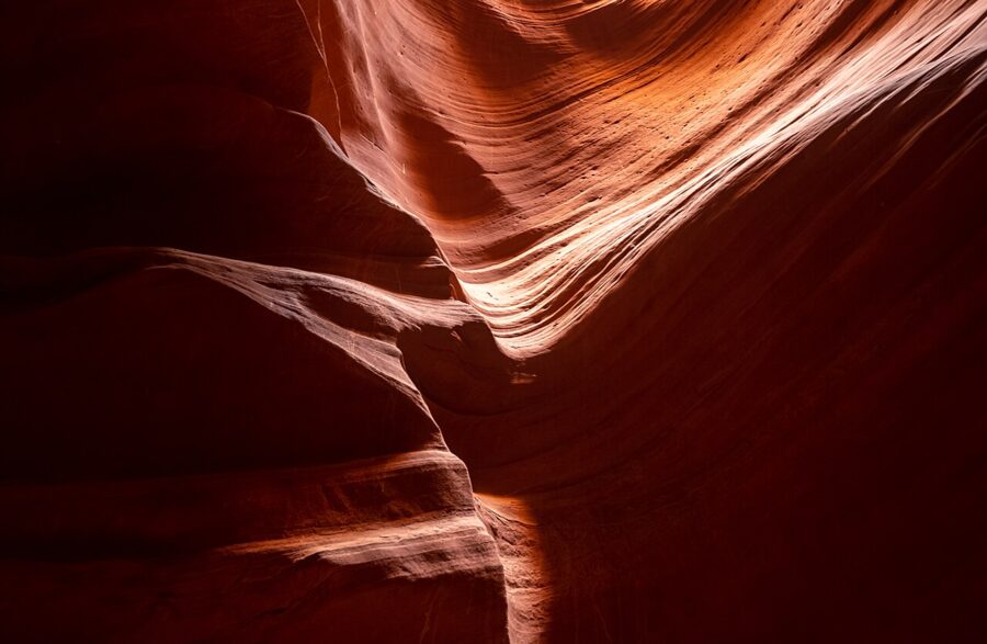
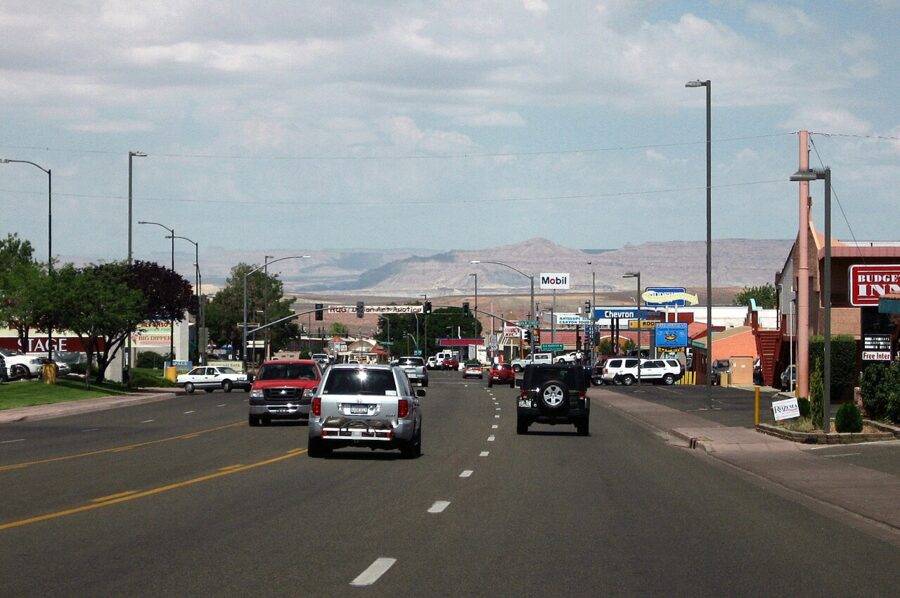
Antelope Canyon is a set of slot canyons on Navajo land just east of Page, cut through soft sandstone by flash floods. You cannot walk in on your own. Licensed Navajo companies run each section, and the price either includes or adds a Navajo park fee, so read the checkout total.
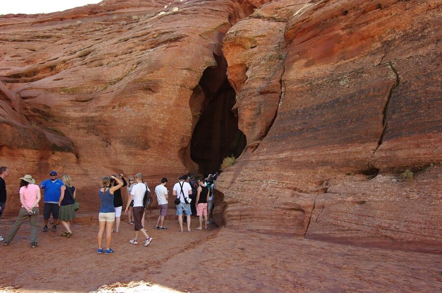

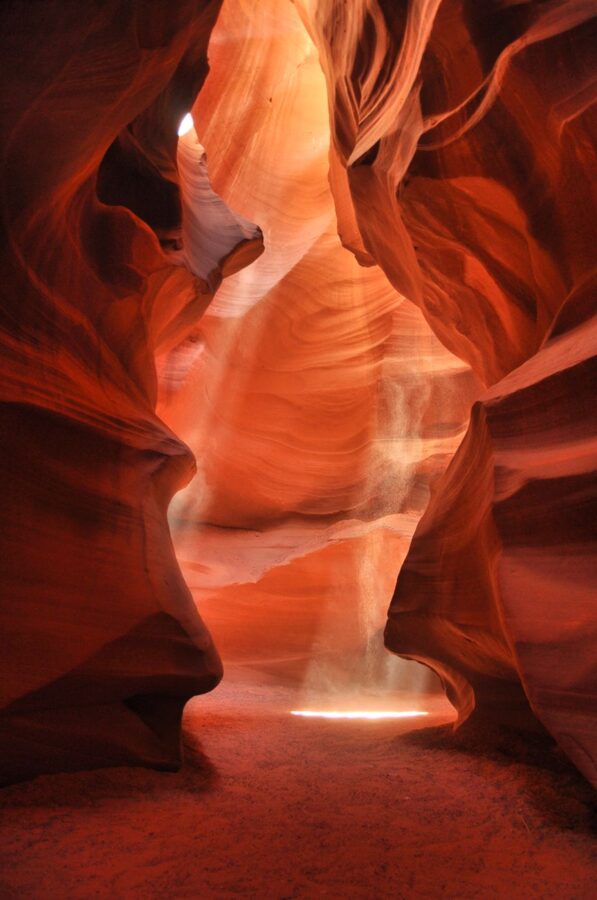
Which section? Upper Antelope is the famous one, with the shafts of light in the photographs, a flat walk and higher prices. Lower Antelope is longer and narrower, with steep metal stairs in and out. If you only have time for one, pick by your knees and your budget rather than the photos.
Tripods and professional camera gear are not allowed on standard tours (Ken’s Tours states this for every tour it runs), and phones are fine. Tours are cancelled when the National Weather Service issues flash flood warnings, which is not a formality: in August 1997 a flash flood swept through Lower Antelope Canyon and killed 11 hikers. From July to September, when the monsoon brings afternoon storms, morning departures are less likely to be called off.
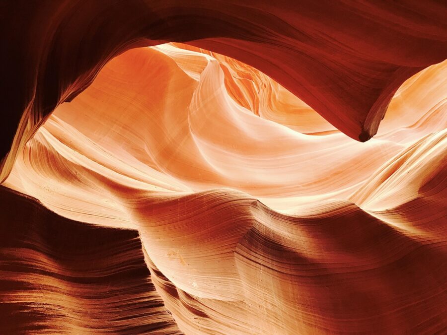
Upper Antelope Canyon
As of November 2026, Antelope Canyon Tours lists its Upper Antelope sightseeing tour at $95 base fare for ages 8 and up, plus a $15 Navajo park fee and card and booking fees, with a lower child fare. The tour lasts about 1 hour 45 minutes including the drive, runs daily all year and leaves from 22 South Lake Powell Boulevard in town. Antelope Slot Canyon Tours lists its Upper tour from $95 for about 90 minutes, ages 6 and up, with prices that vary by season.
One useful tell: Antelope Canyon Tours charges more for its 11:20am departure “due to supply and demand”. That’s the slot when the sun is high enough to throw light down into the canyon, so book it if the beams are why you came, and book it early. Antelope Canyon Tours also says discounts are available in late fall and winter.
Lower Antelope Canyon
Two Navajo companies run Lower Antelope: Ken’s Tours and Dixie’s Lower Antelope Canyon Tours, each from its own check-in a few minutes’ drive east of town. Each lists its general tour from $80.50 per person as of November 2026. Ken’s general tour lasts 50 to 60 minutes and takes bookings of up to 15 people, and its own pages contradict each other on whether taxes and fees are included, so check the total before you pay.
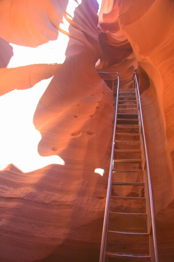

Lower is the better choice if you dislike crowds in a confined space, since the passage is long enough for groups to spread out. It is also brighter than Upper for most of the day, because the canyon opens wider at the top. Skip it if stairs or tight squeezes worry you.

Antelope Canyon X and the quieter slots
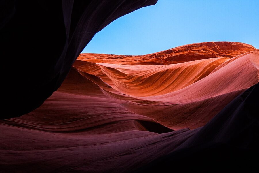
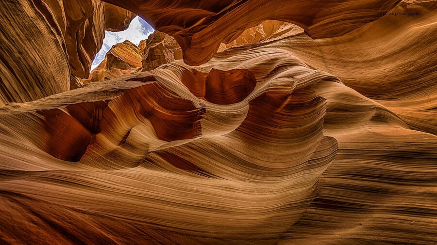
If Upper and Lower are sold out, or you want fewer people around you, Navajo Nation Parks lists several other permitted slot-canyon operators near Page. Taadidiin Tours runs Antelope Canyon X, a section on the same wash with tall, wave-shaped walls. Waterholes Canyon, south of town off US 89, is another guided-only slot.

Horseshoe Bend
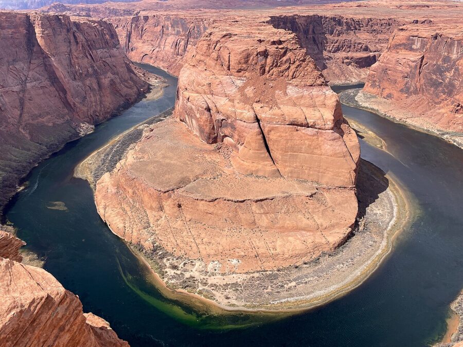
Horseshoe Bend is the 270-degree loop the Colorado River makes around a sandstone fin about 5 miles south of the Carl Hayden Visitor Center, roughly 1,000 feet below the rim. The parking lot and trailhead are off US 89 between mileposts 544 and 545; the lot is on City of Page land, while the overlook itself is in Glen Canyon National Recreation Area and the land south of the trail is Navajo Nation.
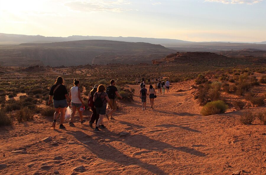

The trail is 1.5 miles round trip on a hardened path that the Park Service describes as accessible under the Architectural Barriers Act. It is downhill on the way out and uphill on the way back, in full sun. The viewing platform has railings; the rest of the rim does not, and the drop is sheer. There are toilets at the parking lot and nowhere on the trail.
Parking costs $10 for a car, truck, SUV or RV and $5 for a motorcycle, under the City of Page fee schedule adopted in June 2026. America the Beautiful and Glen Canyon passes don’t cover it. The lot opens at sunrise and stops admitting cars at sunset, parking on the US 89 shoulder is prohibited, and drones are banned throughout Glen Canyon. Allow an hour, and go at sunrise if you can: cooler, quieter and with the river lit.
Lake Powell
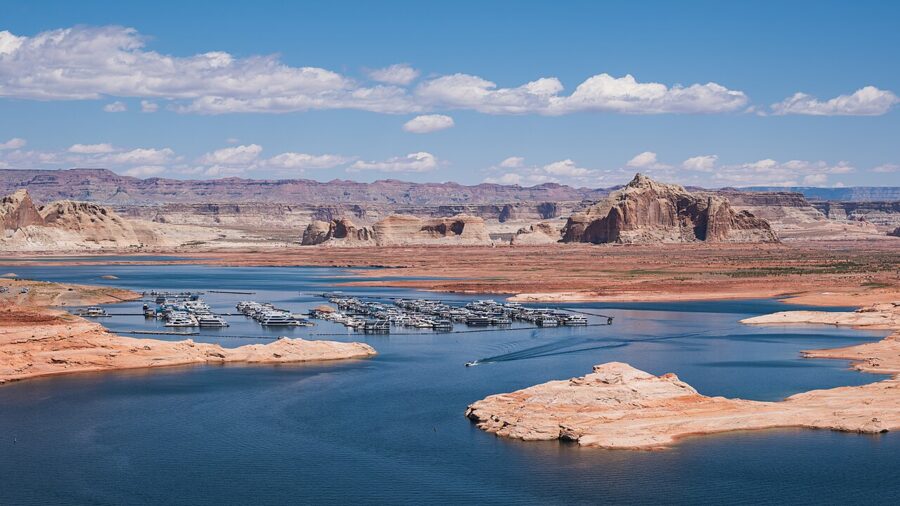
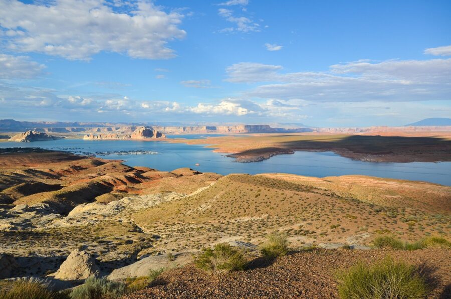
Lake Powell is the reservoir behind Glen Canyon Dam, a maze of flooded side canyons that runs from Page far up into Utah. The south end near Page is where most visitors meet it: Wahweap Marina and Lake Powell Resort to the north-west of town, Antelope Point Marina to the east, and Lone Rock Beach just over the Utah line. Entry to Glen Canyon National Recreation Area costs $30 per private vehicle for seven days, $25 for motorcycles and $15 per person on foot or by bike, as of November 2026, and the park doesn’t accept cash.
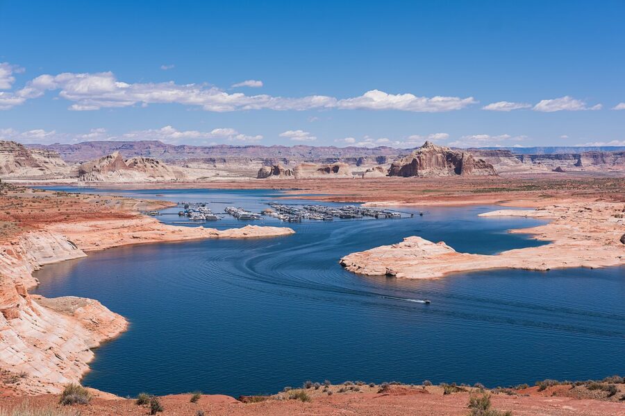

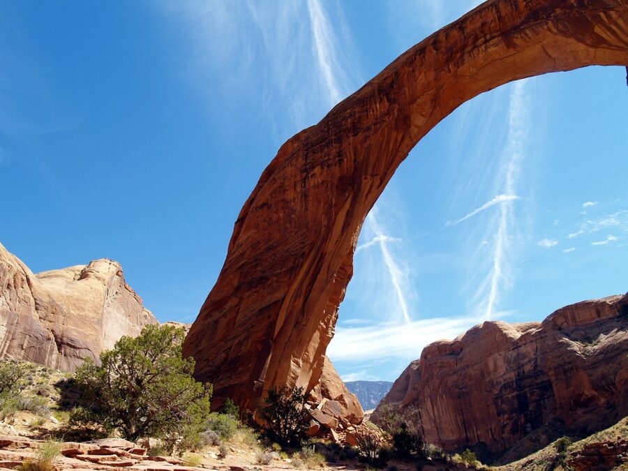
The water level shapes what you can do. As of November 20, 2026, the Park Service listed the Wahweap Main and Wahweap Stateline ramps and the Antelope Point public ramp as closed to motorized boats and open only to paddlecraft at your own risk, with the Stateline auxiliary ramp the one open for motorboats near Page. Rainbow Bridge’s docks have been moved to deeper water, so the monument is “visit at your own risk” for boaters who beach and walk in. The Park Service’s “changing lake levels” page lists what each ramp is doing.
Boat tours that still run
Lake Powell Resorts, the concessioner at Wahweap, listed its Rainbow Bridge tour and its Antelope Canyon boat tour as unavailable until further notice in November 2026. What it does list: a 90-minute Scenic Dam Cruise at $75 per adult and $45 for children 3 to 12, a Navajo Canyon boat tour that passes close to the dam, private boat tours and the two-hour Canyon Princess dinner cruise. The park entrance fee is on top. Be in the Lake Powell Resort lobby 45 minutes before departure.

Swimming, beaches and paddling
For a swim, the Wahweap Swim Beach is the only spot at the south end of the lake where motorboats aren’t allowed past the buoys. There are no lifeguards anywhere on Lake Powell, glass is banned, and the Park Service keeps a standing recreational water advisory, so don’t swim where there’s scum on the water and wash your hands before you eat. Summer water can top 80°F.
Lone Rock Beach, a few minutes over the state line, is the drive-on, camp-on beach: sand, a big sandstone tower in the water and a fee machine that runs around the clock. Soft sand catches cars, so stay on the firm tracks unless you have four-wheel drive.
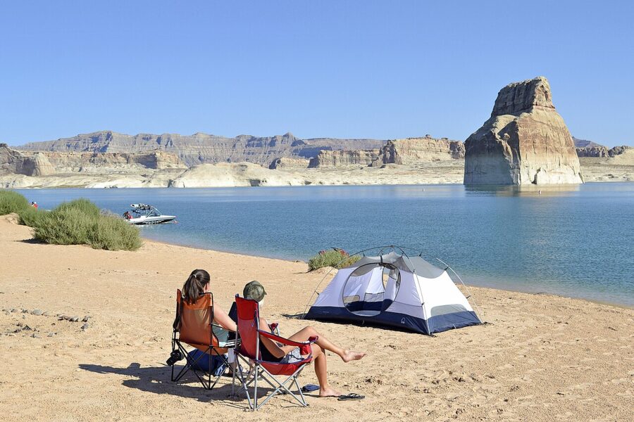
Kayaking is the most flexible way onto the water right now, because paddlecraft can still launch at ramps closed to motorboats. Outfitters in Page rent kayaks and paddleboards and run guided paddles up the flooded lower end of Antelope Canyon from the Antelope Point side. Go early, before the afternoon wind picks up.
Glen Canyon Dam and the overlooks
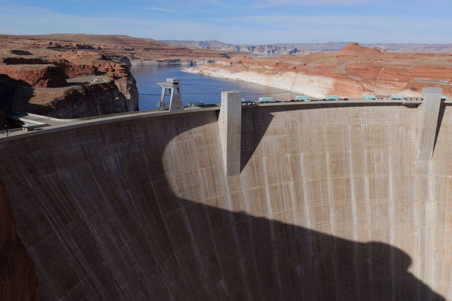
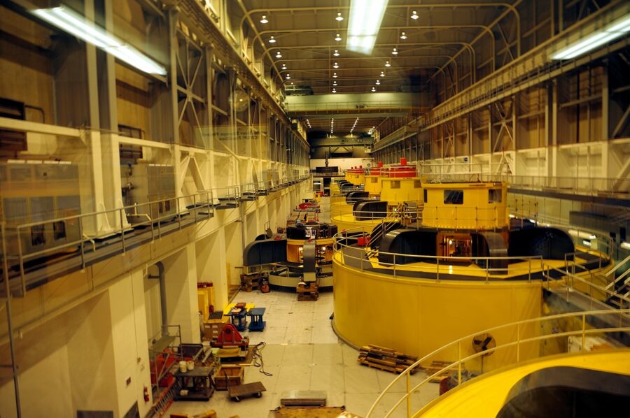
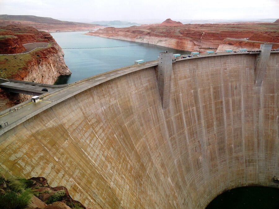
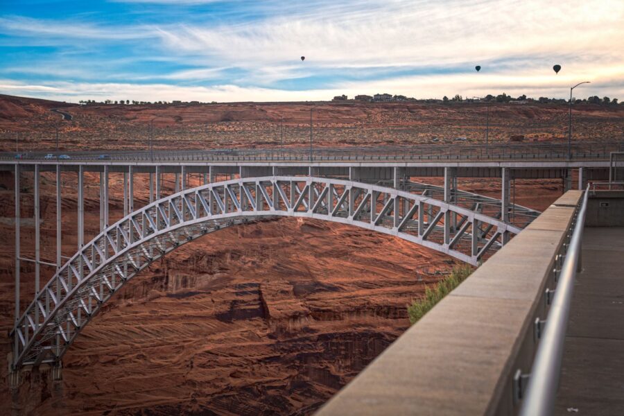
Glen Canyon Dam is the reason Page exists. You can see it from the Carl Hayden Visitor Center on the dam’s west end, from the Glen Canyon Dam Bridge beside it, and best of all from the rim overlooks on the Page side of the river.
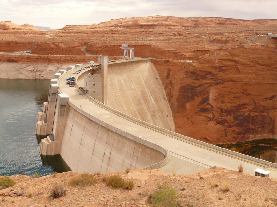
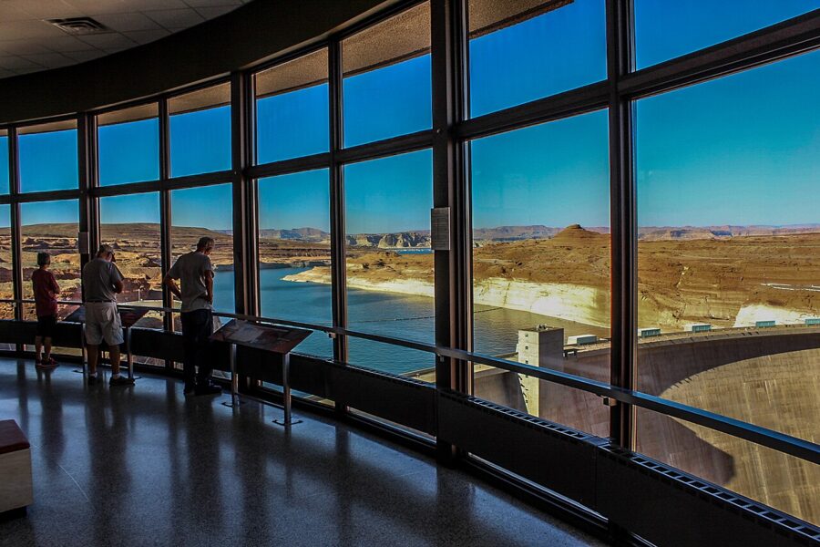
The Carl Hayden Visitor Center is the main visitor center for Glen Canyon and Rainbow Bridge, with exhibits on the dam, the river and the lake, and a wall of windows over the dam face. Its hours as of November 2026 are 9am to 4pm MST daily from November 3 to March 1 and 9am to 5pm MST from March 1, closed Thanksgiving, Christmas Day and New Year’s Day. Allow 45 minutes; the Park Service says dam tours are closed.

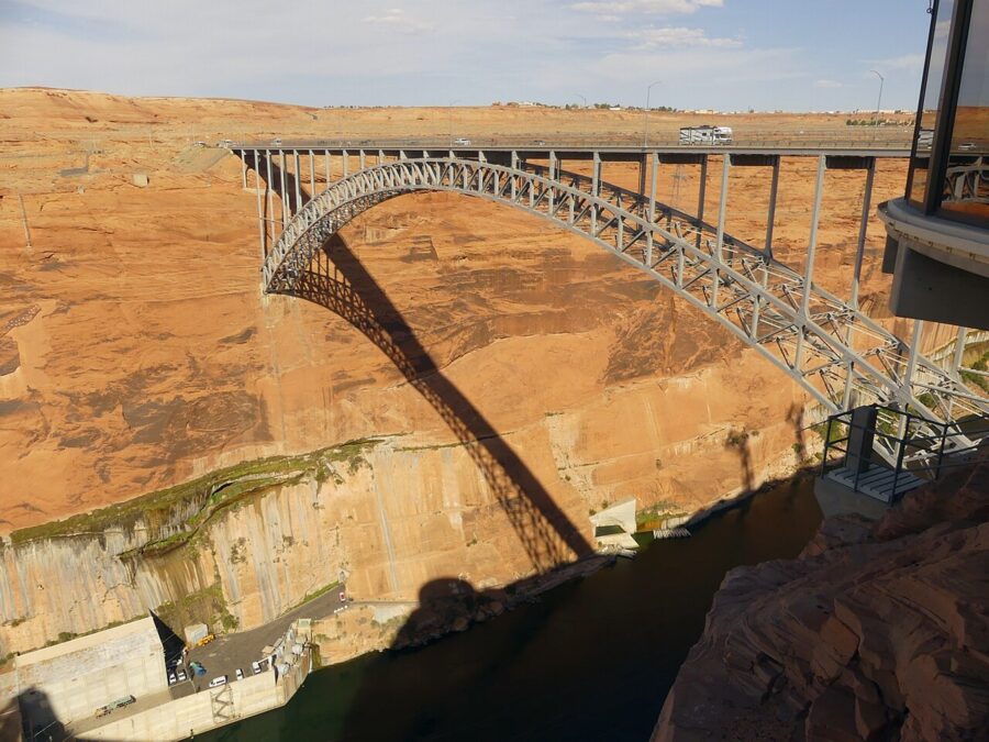
Just downstream, the Glen Canyon Dam Bridge carries US 89 across the gorge about 700 feet above the river, with sidewalks for a look straight down the canyon.

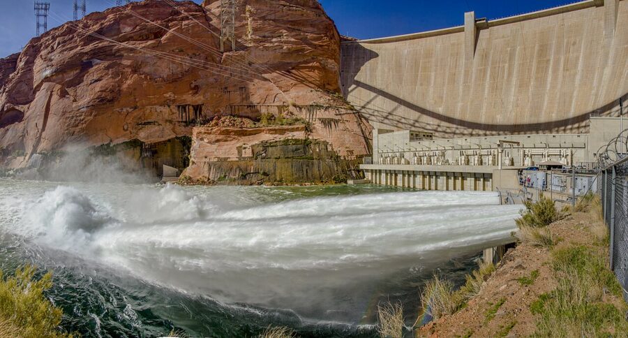

Glen Canyon Dam Overlook
This is the best free view in Page and takes 20 minutes. From US 89, turn west on Scenic View Drive 1.5 miles south of the visitor center, take the first right and park at the end. A 940-foot path with a metal handrail drops down uneven rock steps to a viewpoint on the canyon rim, with the dam, the bridge and the river all in one frame.

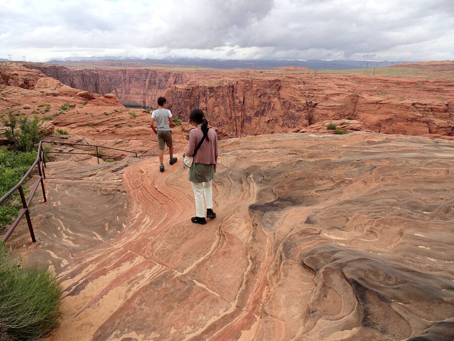

Hanging Garden, Wahweap Overlook and the Beehives
The Hanging Garden trail is a 1-mile round-trip walk, rated easy to moderate, to a seep spring under a sandstone overhang where ferns and other plants cling to the wet rock. The turn-off is a quarter mile east of the Glen Canyon Dam Bridge on US 89, with parking 500 yards off the highway. It’s shadeless, and the garden is small, so go early and for the quiet.
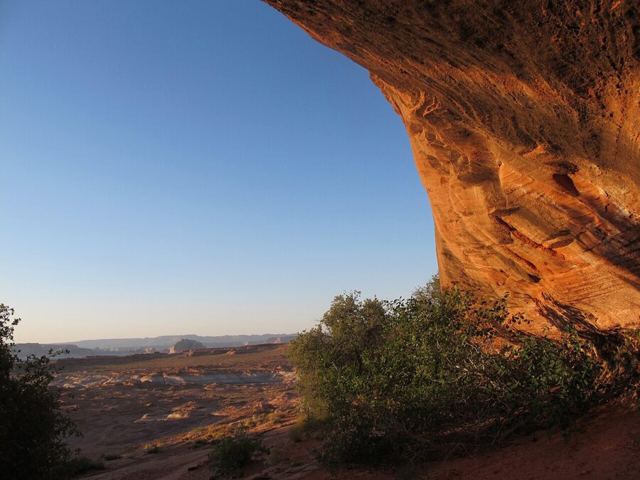
Wahweap Overlook, a short drive past the visitor center toward Wahweap, gives a 360-degree view over the lake, with a shade shelter and a bench. There’s no railing and parts of the edge are slippery. The Beehives area across from the Wahweap entrance road is a free-form wander over slickrock and sand mounds, reached on a dirt road past the Beehives campground.
One closure to know about: the Chains, the informal slickrock and swimming area by the dam, and the road to it were closed on October 30, 2026. The Park Service says bore holes containing detonation cord from the dam’s original construction were found along a restricted service road, that the risk to the dam remains low and that access is restricted while options are assessed.
Smaller things in and around town
The Rim Trail
The City of Page’s Rim Trail is a 10.1-mile loop around the edge of the mesa the town sits on, with views down to the dam, the lake and the desert toward Antelope Canyon. You don’t have to do the whole thing. It has four trailheads with free daytime parking (North Lake Powell Boulevard, Lake View at 20th Avenue, the Airport trailhead and the Page Library), and the northern stretch near the Lake View trailhead is the part closest to the lake.
The Powell Museum and the Glen Canyon Conservancy
The Powell Museum at 6 North Lake Powell Boulevard told the story of John Wesley Powell’s river expeditions and the building of Page. In 2026 Glen Canyon Conservancy, which runs it, put the building up for sale with an asking price of $1,395,000, saying it could no longer subsidize the museum; the exhibits and archives aren’t part of the sale. It has kept seasonal hours, so check with the Conservancy before going.
Next door, the Conservancy’s Flagship store at 12 North Lake Powell Boulevard works as Glen Canyon’s supplementary visitor center and an official Arizona visitor center, with maps, books and the big carved relief map of the Glen Canyon area. As of November 2026, it is open 9am to 4pm Monday to Friday through March 1, and 9am to 5pm Monday to Saturday the rest of the year.
Navajo culture
Red Heritage, at the Dam Plaza on North Navajo Drive, stages a Navajo dinner show with music, dancing and storytelling, and the venue runs on Arizona time. Its schedule is seasonal and the posted dates weren’t confirmed for this article, so check directly before planning an evening around it.
Markets and events by month
- Year-round: the Outdoor Market on Elm runs on the 2nd and 4th Saturday of every month, 9am to 3pm, according to the City of Page events office.
- July: the city’s Fourth of July celebration has a parade, live music and fireworks at Lake Powell National Golf Course; in 2026 the city ran free shuttles from outlying lots instead of opening golf-course parking.
- November: the Page, AZ Balloon Regatta, with morning launches, a street fair and a balloon glow. The 2026 edition ran November 5 to 8.
- December: Christmas in the Park and the Parade of Lights, an evening event from 4pm to 8:30pm.
Day trips from Page
Alstrom Point
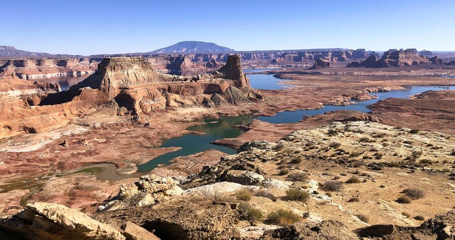
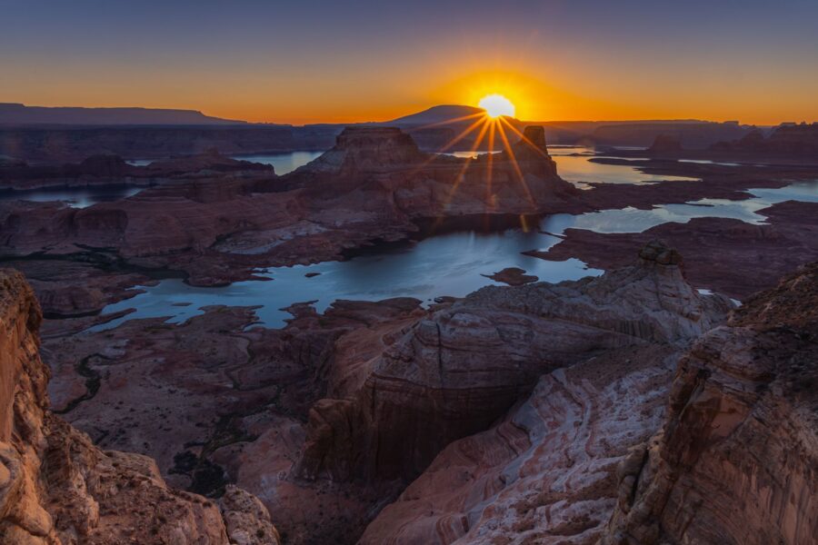
Alstrom Point is the famous overlook above Gunsight Bay, with Gunsight Butte, the lake and Navajo Mountain spread out below. The Park Service describes it as a 46-mile round trip on “semi-improved roads” from near Big Water, Utah, about four hours if you only drive there and back. The last stretch needs high clearance and four-wheel drive and turns impassable when wet, so most people go with a local guide, usually for sunset.

The Toadstool Hoodoos
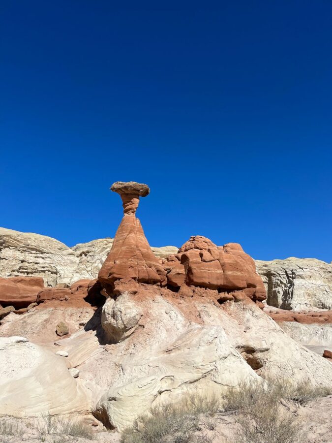
The Toadstools are mushroom-shaped rock pillars in Grand Staircase-Escalante National Monument, just over the Utah line. The trailhead is a dirt lot on US 89 just past Utah milepost 19, about 29 miles west of Page, and the out-and-back walk up a sandy wash is about 1.5 to 2 miles round trip. It’s free and unshaded: allow 2 to 2.5 hours from Page including the drive, and go early or late for the light on the white and red rock.
Lees Ferry and Navajo Bridge
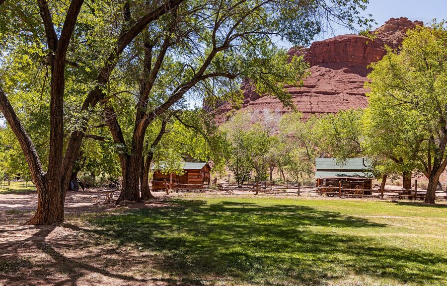
Lees Ferry, 44 miles from Page by road, is where the Grand Canyon river trips launch and where the old ferry crossing once linked Utah and Arizona. It’s in Glen Canyon National Recreation Area, so your entrance pass applies, and the automated fee station takes cards only. The Lonely Dell Ranch historic site and Cathedral Wash are the reasons to stop.
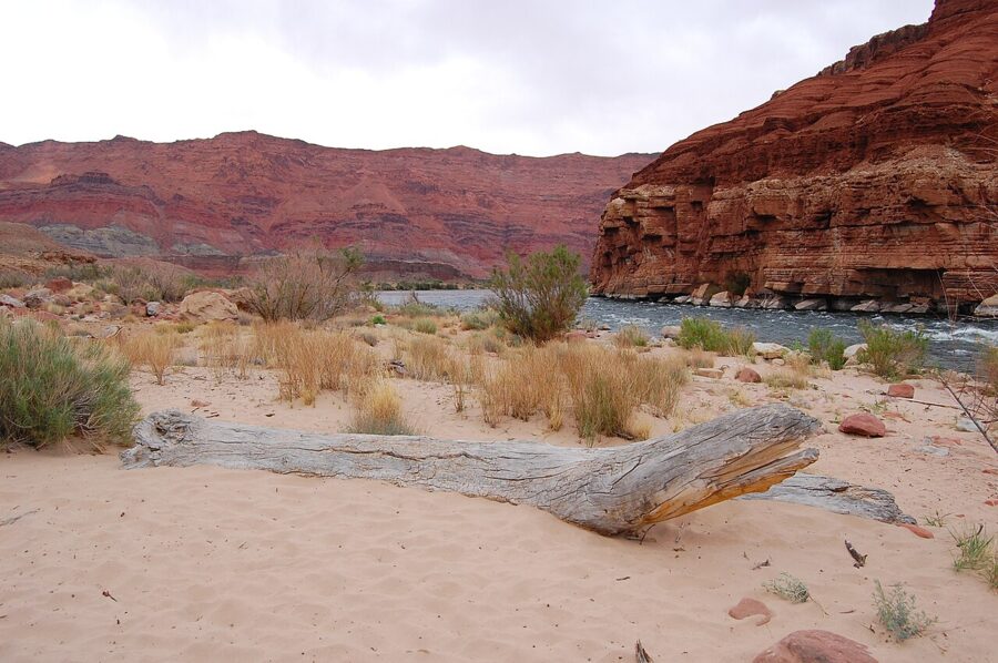


The Park Service rates Cathedral Wash as a challenging 3-mile round trip of 3 to 4 hours, scrambling down a rocky dry wash to the river through the Kaibab Limestone and Toroweap formations. Never go in if storms are around.
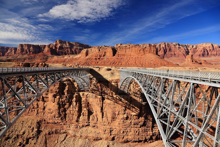
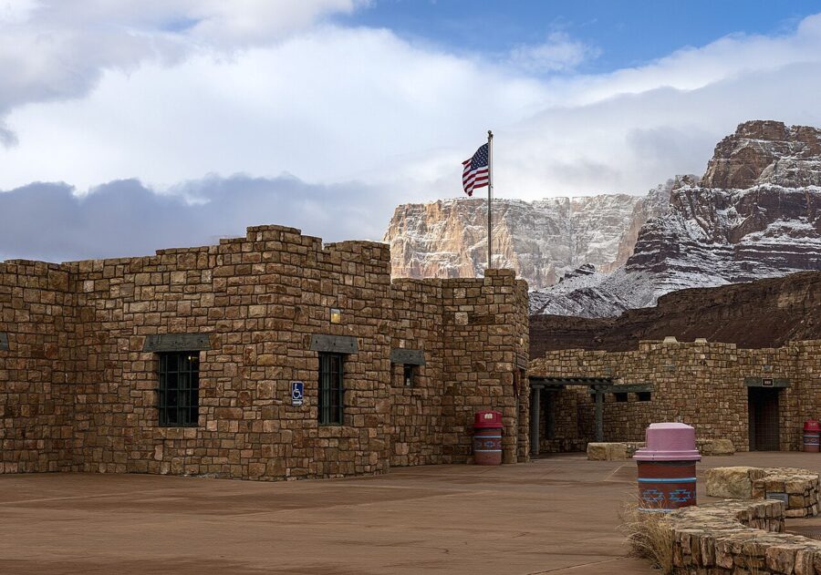
On the way, the two Navajo Bridges cross Marble Canyon side by side: the 1929 historic bridge, now for walkers only, and the newer road bridge. The Navajo Bridge Interpretive Center on the west side is open 9am to 4pm MST daily from November 3 to March 1 and 9am to 5pm from March 2 to November 2, closed on the major winter holidays. Look up from the bridge: it is one of the best places in the area to see California condors.


Farther afield
The Grand Canyon’s South Rim is about three hours away, a long day trip; Kanab, Zion and Monument Valley are 1.5 to 3 hours by car. The Wave in Vermilion Cliffs needs a permit won in a Bureau of Land Management lottery.
Where to eat and drink
Page eats early. Most kitchens close by 9pm and some by 8pm, so if you’re coming back from a sunset at Horseshoe Bend, pick dinner before you go. Every place below was trading in November 2026; hours are as each restaurant listed them that month and can change with the season.
Breakfast and coffee
- Lake Powell Espresso, 625 Elm Street: coffee and breakfast from 6am to 2pm daily, early enough for a sunrise start.
- Ranch House Grille, 819 North Navajo Drive: a big diner breakfast, 6am to 2pm daily.
- Canyon Crepes Cafe, 669 Elm Street: sweet and savory crepes, 8am to 4pm, closed Tuesday.
- Rustic Thistle, 626 North Navajo Drive: open from 8am for breakfast through dinner, closed Wednesday and closing at 3pm on Sunday.
Lunch
- R D’s Drive-In, 143 South Lake Powell Boulevard: burgers, fries and shakes from 7am, closed Thursday and Sunday.
- Lake Powell Italian Deli, 124 6th Avenue: sandwiches to take to the lake, 7am to 6pm on Tuesday, Wednesday, Friday and Saturday only.
- Big John’s Texas BBQ, 153 South Lake Powell Boulevard: barbecue, 11am to 8pm daily, which makes it as good for lunch as for an early dinner.
Dinner
- Bonkers Restaurant and Steakhouse, 810 North Navajo Drive: steaks and pasta from 4pm, closed Sunday.
- BirdHouse, 707 North Navajo Drive: fried chicken, 11am to 9pm daily.
- Fiesta Mexicana, 125 South Lake Powell Boulevard, and El Tapatio, 25 South Lake Powell Boulevard: the two sit-down Mexican places on the main strip, both open until 10pm, with El Tapatio open until 11pm on Friday and Saturday.
- Strombolli’s Italian Restaurant and Pizzeria, 711 North Navajo Drive: pizza and pasta, closed Thursday and between 2pm and 4pm on weekdays.
- Chothika Thai Cuisine, 750 South Navajo Drive: Thai food, 11am to 9:30pm daily.
- Blue Buddha Sushi Lounge, Dam Plaza, 644 North Navajo Drive: sushi from 5pm, Tuesday to Saturday only.
Drinks
Grand Canyon Brewing + Distillery at 714 North Navajo Drive pours its own beer and spirits from 11am to 9pm, closed Thursday, and the Dam Bar and Grille in the Dam Plaza is open until 9pm most nights.
When to go, and how long to stay
Spring and fall are the sweet spots. Summer is hot and stormy in the afternoons; winter is cold at night but quiet. These are the National Oceanic and Atmospheric Administration’s 1991 to 2020 normals for Page:
| Month | Average high | Average low | Precipitation |
|---|---|---|---|
| January | 45°F | 26°F | 0.65 in |
| March | 62°F | 38°F | 0.54 in |
| April | 71°F | 44°F | 0.38 in |
| May | 81°F | 54°F | 0.44 in |
| June | 92°F | 63°F | 0.13 in |
| July | 97°F | 70°F | 0.58 in |
| August | 94°F | 68°F | 0.93 in |
| September | 85°F | 59°F | 0.93 in |
| October | 71°F | 47°F | 0.92 in |
| November | 55°F | 35°F | 0.45 in |
| December | 44°F | 27°F | 0.42 in |
April, May, late September and October are the best all-round months: warm enough to swim by late May and cool enough to walk at midday. July and August bring the monsoon, when a storm miles away can fill a slot canyon, so expect cancelled tours and plan a morning slot. From December to February you’ll have Horseshoe Bend nearly to yourself at sunrise if you dress for freezing temperatures.
How many days? One full day is enough for Antelope Canyon, Horseshoe Bend and the dam overlooks if you’re passing through. Two days is the right length for most people, adding the lake and a short hike. Give it three if you want Alstrom Point, Lees Ferry or the Toadstools without rushing.
A simple one- or two-day plan
Day one
- Sunrise: Horseshoe Bend, then breakfast at Lake Powell Espresso or Ranch House Grille.
- Late morning: your Antelope Canyon tour; Upper around 11am if you want the light beams, Lower if you’d rather climb.
- Afternoon: the Carl Hayden Visitor Center when the heat peaks, then a walk out onto the Glen Canyon Dam Bridge.
- Before sunset: the Glen Canyon Dam Overlook, then an early dinner in town.
Day two
- Morning: a kayak or paddleboard trip from the Antelope Point side while the lake is calm, or the Scenic Dam Cruise from Wahweap.
- Midday: a swim at the Wahweap Swim Beach or Lone Rock Beach, then lunch from the Italian deli.
- Late afternoon: the Hanging Garden walk and Wahweap Overlook, or the Toadstool Hoodoos if you have a car and a couple of spare hours.
Getting around and practical notes
You need a car. The sights are spread over 20 miles of highway, the canyon tours meet in town or at their own lots on the Navajo side, and there’s no practical way to string them together without driving. Fill up in Page before any day trip.
- Book ahead: Antelope Canyon tours in spring, summer and fall; refund rules differ (Ken’s Tours refunds the ticket price only for cancellations 72 or more hours out, Dixie’s up to 24 hours before, Antelope Canyon Tours at 48 hours).
- No cash: Glen Canyon entrance stations are card-only. Horseshoe Bend takes cards, though carrying cash on major holidays saves a wait.
- Drones: banned in Glen Canyon National Recreation Area and Rainbow Bridge National Monument without written permission.
- Heat: carry more water than you think you need on every walk, including the short ones; there’s none on the Horseshoe Bend trail.
Where to stay depends on what you came for. Lake Powell Resort at Wahweap puts you on the water, the chain hotels on North Navajo Drive and Lake Powell Boulevard keep you in walking distance of dinner, and campers have Lone Rock Beach and the Wahweap campground. Whichever you choose, set an alarm for sunrise on day one: the Horseshoe Bend gate opens then, and the first half hour is the best of the trip.